Back to Fire Weather Homepage
1300EST Observation Maps*
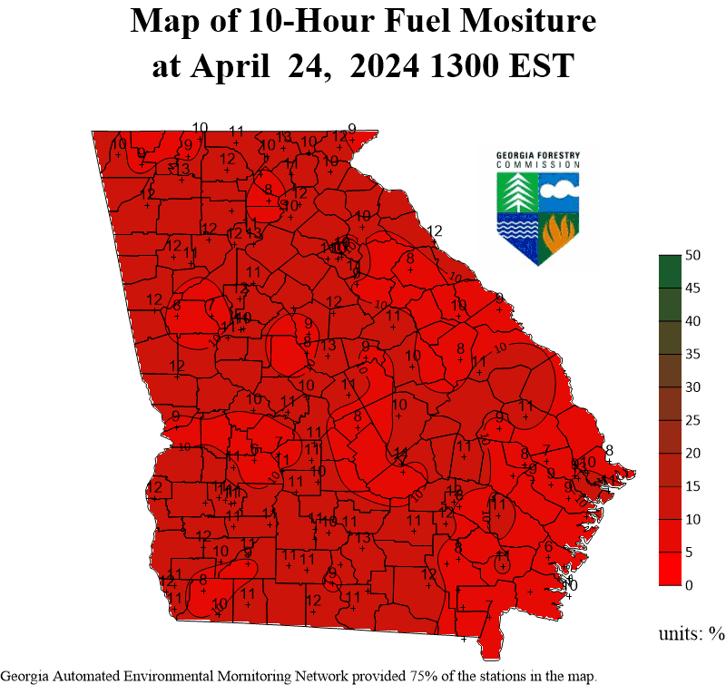
10 Hour Fuel Moisture
Fire Danger
(Manning Class)
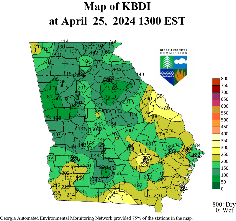
KBDI
(Keetch-Byram Drought Index)
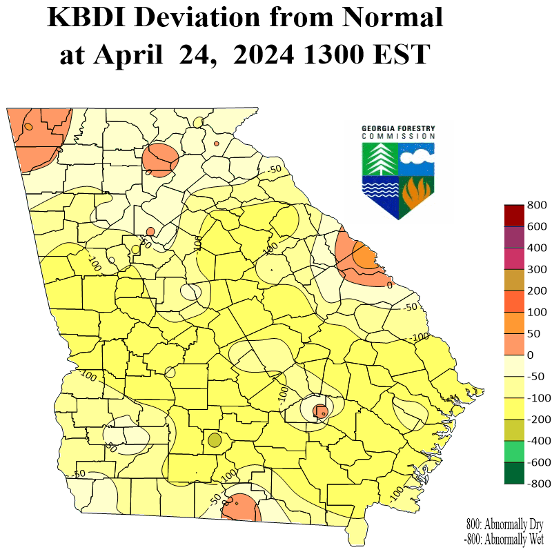
KBDI Deviation from Normal
Last 24 Hour Rainfall
Relative Humidity
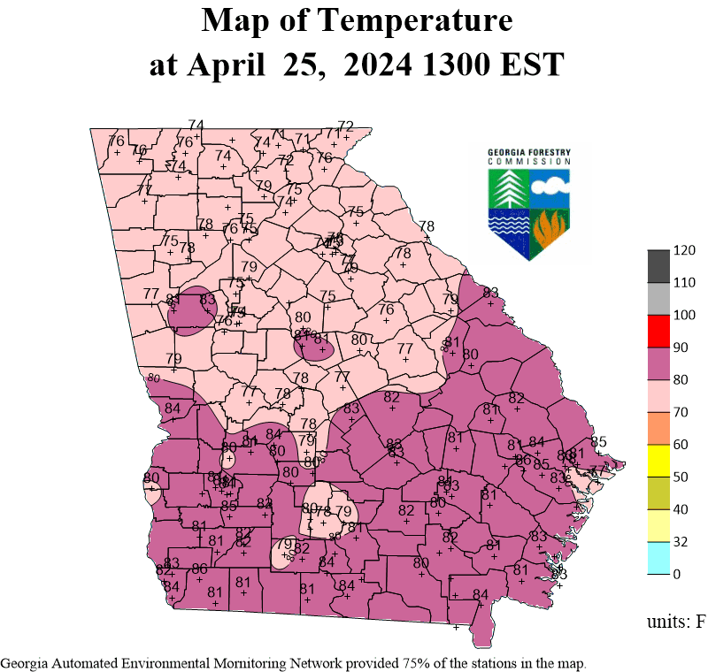
Temperature
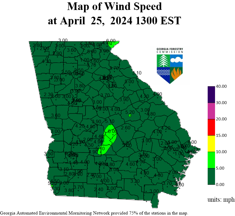
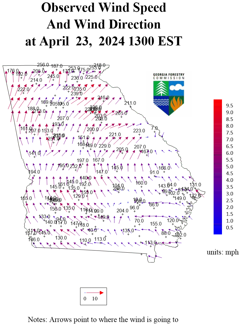
Wind Speed
Wind Direction
Forecast Fire Danger
Last 24 Hour Rainfall
(from NWS updated at 3pm EST)
US Drought Monitor for Georgia
USGS National Waterboard
NASA Short-term Prediction Research and Transition Center
NCEI - Drought Termination and Amelioration
- by Climate division
Forecast Maps from NWS
Graphical Forecast
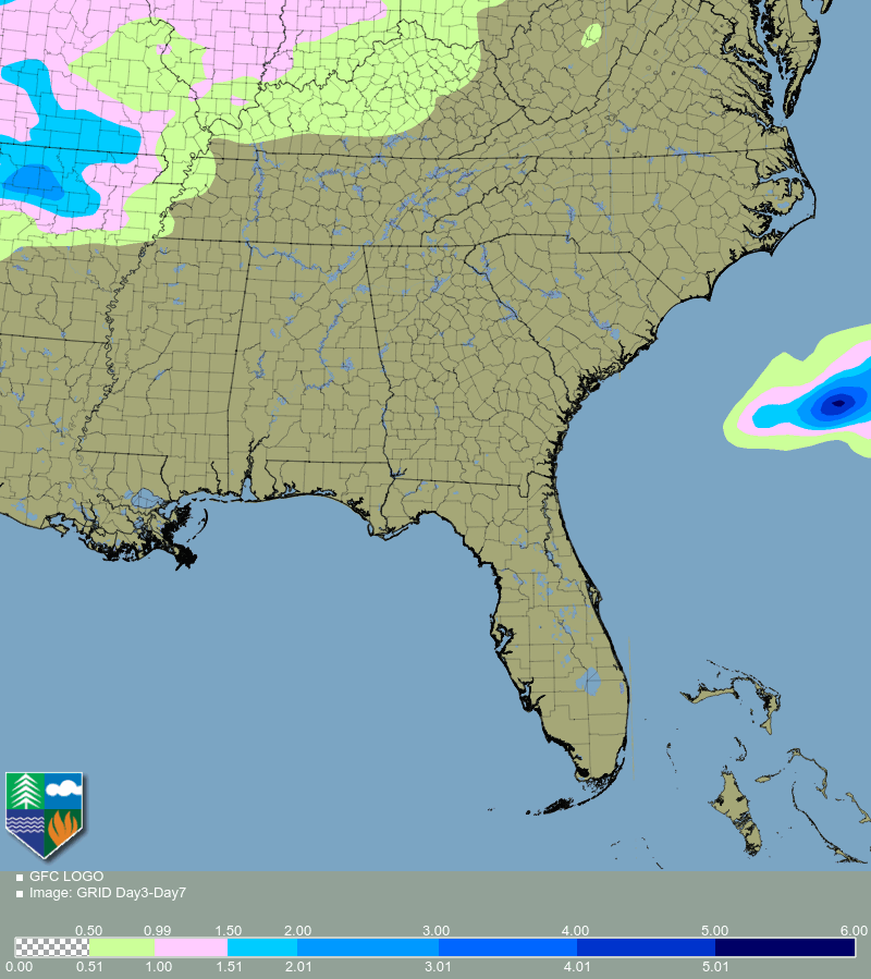
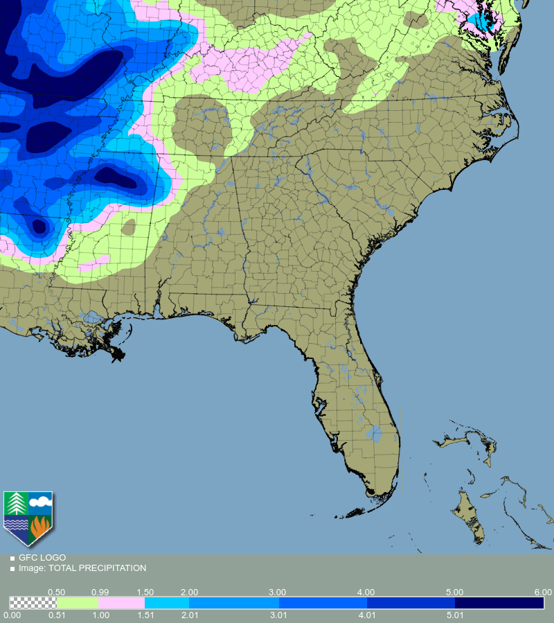
Forecast Total Rainfall for the next 7 days
- from
Weather Prediction Center
Forecast For Southeast US
Next 3 Days
Day 4 - Day 7
Next week
*Unless otherwise stated, observation Maps are updated daily at 200pm EST. Observations from University of Georgia's
Automated Environmental Monitoring Network
are added to the Maps at around 230pm EST.
Copyright © 2026 Georgia Forestry Commission. All rights reserved.